
- 1 What will the weather be like in the coming days?
- 2 What weather should we expect in March?
- 3 What precipitation is possible in the first month of spring?
- 4 Can severe frosts of -20 return?
- 5 Should we expect a sharp warming?
- 6 When will spring and warmer weather come?
- 7 How will March this year be different from last year?
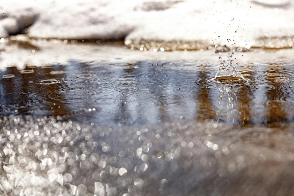
The difficult winter with severe frosts, snowfalls, and bad weather is coming to an end, but the first signs of spring are appearing on the horizon in Ukraine. In most regions, it has already warmed up, the weather is even sunny, and the snow has already melted almost everywhere.
Ivan Semilyt, a representative of the Ukrhydrometeorological Center, spoke about what the weather will be like in Ukraine in March – whether to expect a sharp warming or, conversely, the return of frost and snow, and whether we are approaching a stable and warm spring – in an interview with Channel 24 .
What will the weather be like in the coming days?
How will the weather change in Ukraine in the near future and can we expect precipitation to return?
In general, in the next 3 days we expect weather without precipitation due to the influence of a high atmospheric pressure field, so clearing is expected, particularly at night. At night and in the morning, with the exception of the south and extreme west, a new layer of ice may form in places.
Also on February 28, there will be fog in most of the central, Sumy and Kharkiv regions in some places. The wind will be southwesterly, changing to northwesterly, with a speed of 5-10 meters per second.

Fog is possible in some places in the coming days / Unsplash, Pascal Debrunner
The air temperature at night is expected to be from +1 to -6 degrees. During the day, the thermometer will rise to 0…+7 degrees. In the west and south of the country, it will be slightly warmer – +6…+13 degrees. This weather forecast situation awaits us in the next 3 days.
During March 3-4, particularly on the 3rd, light rain and snow are possible in places on the Left Bank and in the northern regions due to the passage of an atmospheric front from the north. No precipitation is expected in all other regions.
Temperatures will remain mostly within the same range – at night within 0…-6 degrees, and during the day up to +6 degrees. In the west of the country, it will warm up to +7…+13 degrees.
Are there any signs that might indicate that there will be less ice on the roads in the near future?
Due to sunlight during the day, the snow cover may melt. But at night, the air temperature will drop again to 0 or minus values, i.e. slight frosts. Because of this, ice will still form in places at night and in the morning.
That is, the snow or ice cover that we have now will melt during positive temperatures, and freeze during the night and morning hours, when the temperature values are the lowest during the day, resulting in ice. Therefore, for the time being, this is exactly the process that will occur.
What weather should we expect in March?
What will the weather be like in the first month of spring, according to the forecast of the Ukrhydrometeorological Center?
If we look at the forecast of average monthly air temperature and precipitation in March 2026, we expect from 1 to 7 degrees Celsius, which is within normal limits. In the Western, Zhytomyr, Vinnytsia and Odessa regions, it will be 1.5 – 2.5 degrees above normal.
Monthly precipitation is expected to be within 30 – 53 millimeters, in mountainous areas of Lviv, Frankivsk, Zakarpattia regions and in the mountains of Crimea in places it may be 60 – 98 millimeters, which is generally within the normal range of 80 – 100%.
What precipitation is possible in the first month of spring?
Is it possible that snowfall and rain will return this month?
In general, March is a transitional month between winter and spring, so such fluctuations, and, so to speak, weather swings, are, in principle, possible. However, current trends regarding the synoptic situation during March, in particular in the first decade of the month, do not indicate this.
However, we understand that this is a transitional month, the weather is constantly changing, the atmosphere is moving, and in principle anything can happen. We will monitor how the synoptic situation changes and report more in detail in a shorter period.
Heavy rainfall is not expected this month yet / Unsplash, Shashi Chaturvedula
The climatic characteristics of March are variable, and according to them, the average monthly precipitation is 26 – 51 millimeters, and in Transcarpathia and mountainous areas it reaches up to 106 millimeters in places. In the highlands of the Carpathians, the figure is up to 135 millimeters.
Throughout March, ice and sleet are still observed, there are strong winds, and generally at the end of March, or even in the middle of the month, depending on temperature values and processes in the atmosphere, thunderstorms even begin.
We cannot yet say whether there will be snowfalls or whether there will be, for example, the same thunderstorm, as these are short-term phenomena that can be seen about 3 days before they begin. However, it is possible, and in general, weather fluctuations are also possible in March.
Have there been previous cases where, after a cold winter, snow fell in April, for example?
We can remember, for example, 2013. I don't remember exactly what the winter period was then, but at the end of March, specifically on the 23rd, a significant amount of snow fell in Kyiv. It was truly an emergency situation then.
In this case, it is difficult to compare with what January and the winter period in general were like then, since you need to see all the values. So is it possible for us to have such snow this year? In principle, yes. But now it is difficult to say whether it will actually happen, since we are making short-term forecasts.
Could severe frosts of -20 return?
Is there a possibility of a return to -20 degrees Celsius in Ukraine, as was the case in January and the first half of February?
If we return to the climatic characteristics of March, and consider the last climatic period – from 1991 to 2020, it was recorded that the absolute minimum temperature is from -20 to -33 degrees.
Is it possible again? Yes, of course, it is possible. But now it is very difficult to say whether it will happen this year, since such values are not expected in the first decade of March. Therefore, there will be no such significant temperature drops to -20…-30 degrees yet. But again, everything is constantly moving and, as we can see, such temperature drops have occurred in the history of observations.
Should we wait for a sharp warming?
Is it possible for the temperature to rise to +20 in March, for example, in the southern regions, where the indicators are traditionally higher compared to other regions?
Here it is the same as with the above-mentioned minimums. That is, such maximums can also occur, since the maximum temperature values during March range from +19 to +30 degrees, slightly lower temperatures were observed in the Carpathians.

No sharp warming is expected in March yet / Unsplash, Heye Jensen
And right now it's also difficult to say whether such temperatures will occur. Usually, the average daily air temperature changes by 5 degrees, that is, towards an increase, in the third decade of March.
In the southern part, this may begin earlier – in the second decade. In the northeast of the country, such a transition is generally expected in early April due to the continental climate. But this is only a climatic characteristic, so it is unknown whether it will happen the same this year.
When will spring and warmer weather come?
Are there any preliminary forecasts that would indicate when a true spring will begin?
In the next 5 days, temperatures in the southern and western regions, namely daytime highs, will be within +8…+13 degrees. Although these are not very high temperature values, they already hint at spring. However, slight frosts are still possible at night.
But this is not what we had in February, and now there is already a trend towards spring. At the same time, it is not worth guaranteeing high temperatures or significant warming yet, because we understand that everything can change.
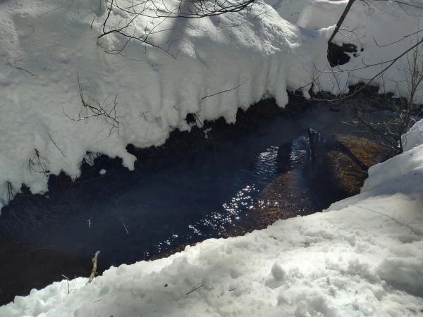
Could such an increase in temperature cause flooding?
Our hydrological forecasting department is currently issuing warnings about dangerous hydrological phenomena and changes in the hydrological regime. For example, from February 27 to March 2, the water level in the rivers of the Pripyat sub-basin (part of the large river basin – Channel 24) and the Pripyat River is expected to rise by 20 – 70 centimeters above current levels.
In some places, water may leak, which is the first level of danger.
There will be further weakening and destruction of ice on rivers, and ice drift will form in places. That is, the ice that formed during severe frosts begins to melt, and as a result, there are certain fluctuations in water levels.
Due to rising temperatures and further melting of snow, as well as water management activities, on the section of the Southern Bug River, specifically within the boundaries of Oleksandrivka and Mykolaiv, and on individual rivers of the Southern Bug basin and its tributaries in the Kirovohrad region, water levels are expected to rise by 0.2 – 0.6 meters, with water retention in floodplains in the Kirovohrad, Cherkasy, and Odessa regions, which is the first level of danger, yellow.
Partial heating of residential buildings on some streets in Kropyvnytskyi is also possible, which is already the second level of danger – orange. Therefore, it is worth monitoring the warnings of hydrologists of the Ukrainian Hydrometeorological Center and the State Emergency Service. But such a situation is possible not only in the Kirovohrad region.
Thaw may cause flooding in some areas / Unsplash, Ludwig Theodor von Ruhm
For example, in the Odessa region, from February 27 to March 2, flooding of floodplains and adjacent areas on the Tyligul River is possible, in particular, with flooding of private estates and houses in Berezivka, which is the first level of danger. It is possible to reach the mark of partial flooding of private houses in the village of Viktorivka, Berezivskyi district, which is the second level of danger.
How will March this year be different from last year?
If we compare, can we say whether this March will be warmer or cooler than last?
In general, as we say among ourselves, comparing 2 years is not indicative. We always compare the year with the climate norm that we have – from 1991 to 2020. In this case, we really see how everything is changing, and meaningful comparative analyses are created that give real conclusions.
As for the current forecasts, we do not expect any significant changes that would differ from the climatic norm. As I have already said, we expect that only in the western, Zhytomyr, Vinnytsia and Odessa regions the average monthly temperature will be 1.5-2.5 degrees higher than the norm.