Main points
- Dubai plans to integrate drones into urban infrastructure through a system of virtual corridors for safe flight in dense urban areas.
- The system uses special algorithms to optimize drone routes, as well as balancing traffic to avoid congestion in the air.
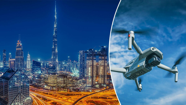
How new technology will streamline the movement of thousands of drones / Collage 24 Channel/Unsplash
Scientists have unveiled a massive plan to reshape Dubai's urban skies, based on the creation of a complex system of virtual corridors. The project aims to solve the problems of safety and flight coordination in the densely built-up metropolis, where drones are becoming an integral part of the logistics ecosystem.
How will the intelligent airspace management system work?
The rapid development of drone technology poses new challenges for modern megacities. It is expected that by 2025, the commercial drone fleet in the United States alone will exceed 800,000 units, which is 70% more than in 2020. The European Union predicts that by 2050 the number of civilian drones will reach 400,000 units, and the annual value of this market will exceed 10 billion euros. In Ukraine, after the war, drones should also be expected to appear on the streets, unless there is an outright ban. In such conditions, low-altitude airspace needs to be clearly regulated to avoid risks to people, buildings and other air traffic, writes Tech Xplore.
A recent study published in the scientific journal Annals of Operations Research proposes a revolutionary concept for cities with dense high-rise buildings, choosing Dubai as the main testing ground. An international team of scientists from the University of Sharjah (UAE), Linköping University (Sweden), Bangor University (UK) and Dar AlSinah have developed an integrated framework that combines airspace design, routing and load balancing.
The research is based on a new way of structuring urban airspace using a grid structure aligned with urban infrastructure, such as road networks and building layouts,
– commented the lead author of the study, Ali Cheitou, who holds the position of Professor of Supply Chain Management, Aviation and Transportation at the University of Sharjah.

Main rules
The proposed model divides the sky over Dubai into two main levels depending on the height of the buildings:
- The first, “red” layer, is intended for areas with skyscrapers over 72 meters high. Here, drones should fly exclusively over major highways.
- The second, “yellow” layer, covers areas with buildings below 72 meters, where drones can fly both over roads and over the roofs of buildings.
- The maximum permitted operating height is 122 meters.
To ensure safety, clear standards for “remain well clear” (RWC) distances have been developed. Drones that are not carrying people must be at least 61 meters horizontally and 46 meters vertically. Drones must be kept at a distance of 30 meters horizontally and 50 meters vertically from fixed objects and obstacles.
Dubai is a unique and challenging test bed, where the density of high-rise buildings and rapid urban development require innovative approaches to structuring and managing air mobility,
– said Imad Alsyuf, professor of the Department of Reliability and Quality at the University of Sharjah and co-author of the work.
Mathematics and algorithms come to the rescue
A key element of the system is the use of complex mathematical models and artificial intelligence to optimize routes. The researchers compared several methods, including genetic algorithm (GA), Tabu search (TS), simulated annealing (SA), and adaptive large neighborhood search (ALNS).
The results showed that the genetic algorithm is the most effective for large scenarios, providing 9% higher profits for logistics operators compared to other methods, while reducing computation time by two-thirds.
Advanced optimization, heuristics, and artificial intelligence algorithms are needed to transform complex urban air mobility problems into actionable solutions in real time,
– Ali says to Chet.
Best traffic for drones
In addition to point-to-point path planning, the system includes a traffic balancing mechanism. It prevents excessive concentration of drones in certain segments of the grid, evenly distributing the load across the entire network.
This is critical to avoid air congestion and ensure equal access to resources for different operators.
Everyone involved
The project is implemented according to the “triple helix” principle, which involves close collaboration between academia, industry and government. The development and validation involved organizations such as the Dubai Air Navigation Authority (DANS), the UAE General Authority for Civil Aviation (GCAA), as well as Swedish partners SAAB and air navigation service provider LFV.
“The strengths of this work lie not only in its technical contribution, but also in the collaboration between academia, industry and government across borders, which allows for solutions based on real operational needs,” emphasized Imad Alsyuf.
What's wrong with this idea?
Despite successful simulations using real-world maps and building heights in Dubai, the developers acknowledge some limitations. The model currently does not account for dynamic weather changes, such as strong winds, and does not simulate battery charging processes in real time.
Future research will focus on integrating the charging station network and implementing AI-based forecasting tools.
You may also be interested in learning: How drones are integrating into urban life around the world
Cities around the world are gradually moving into the era of “low-altitude aviation”, where drones and other unmanned systems are becoming part of everyday life. If a decade ago drones were associated mainly with military technology or amateur photography, now they are increasingly integrated into logistics, transportation, construction, infrastructure, security and medicine.
Many countries are already testing or partially using drone delivery. Amazon, for example, expanded its Prime Air service in the United States in 2026, where drones will make more than a hundred deliveries a day, writes Axios. Drones carry small packages, medicines, food and other goods. Such systems are of particular interest to megacities, where traffic jams have become a chronic problem.
Drones are already being used to monitor traffic, inspect bridges, power lines and buildings. In some cities, drones are helping police and rescue services respond more quickly to accidents, fires or search for people. China is actively integrating drones into the concept of “smart cities”, and in the Gulf countries, drones are seen as an important element of the future transport system.
The most ambitious direction has become air taxis – electric vertical takeoff and landing vehicles, known as eVTOL. This is something between a helicopter and a large drone. Such vehicles have several electric motors, are able to take off vertically from the roofs of buildings or special platforms and transport passengers above traffic jams. Unlike helicopters, they are much quieter and cheaper to operate.
Dozens of companies are working on such systems, including Joby Aviation, Archer Aviation, Volocopter, EHang, Lilium, and Wisk Aero. In China, EHang is already conducting commercial flights of autonomous eVTOLs for tourist routes, writes eVTOL.Travel. In the US and the UAE, Joby and Archer plan to launch the first air taxi services in 2026.
Dubai has become one of the main testing grounds for this industry. “Vertiports” are already being built there – special platforms for vertical landing of air taxis. Similar projects are also being launched in New York, Abu Dhabi, Singapore and Tel Aviv. Some of the routes are focused on transfers between airports and city centers, where a car trip can take an hour, and eVTOL is able to cover the route in 10-15 minutes.
What danger awaits our cities if drones fly uncontrollably in the sky?
Despite the companies' optimism, the main problem remains airspace regulation. If thousands of drones appear en masse in cities, it will create a new type of traffic chaos – no longer on the roads, but in the sky, analyzes 24 Kanal .
- Without centralized control, drones can start to interfere with each other, create traffic jams in the air, and provoke accidents. Areas near skyscrapers, airports, hospitals, and densely populated neighborhoods will be especially dangerous. Unlike cars, an accident with an aerial vehicle threatens not only the passengers, but also the people below.
- The situation is complicated by weather conditions. Rain, strong winds, snow, fog or icing can critically affect flight stability. This is especially important for large eVTOLs, because human lives are at stake. In addition, even electric air taxis create noise. If there are many such devices, cities may face a new type of noise pollution, which is already considerable in megacities.
- Cybersecurity will be a separate issue. Unmanned systems rely heavily on GPS, sensors, communications, and software. Theoretically, a hacker attack or a control system failure could cause the device to crash or lose control of the vehicle, which could be intentionally directed into a house or a person.
That is why countries are already creating UTM systems – Unmanned Traffic Management. This is a kind of “control center” for drones, which will automatically control routes, altitude, flight priority and prevent collisions. In fact, humanity is trying to build an analogue of automobile traffic, but in three-dimensional space.
When will aerial drones start transporting people like taxis?
Most experts agree that mass air taxi flights will not begin until the second half of the 2020s, Channel 24 noted. The first will be expensive premium routes in selected cities. Full integration into public transport, where air taxis will become available to the general population, may take until the 2030s.
The main barriers remain certification, safety, infrastructure construction, and high cost. Even in the US, the Federal Aviation Administration has only recently finalized regulations for eVTOL certification. Companies also need to build a network of landing pads, charging stations, and air traffic control centers.
Despite this, the industry has already moved from the stage of futuristic concepts to real tests. In many cities around the world, eVTOLs are no longer perceived as fantasy. They are gradually becoming a new type of urban transport that can change the very architecture of megacities and the idea of urban mobility.