Main points
- Meteorologists are recording the likelihood of El Niño returning in 2026, which could lead to new heat waves around the world.
- El Niño, associated with warming ocean surfaces, can affect atmospheric conditions, causing droughts and floods in different regions, which is important for agriculture and energy.
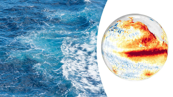
Climate seesaw 2026: how warming ocean waters will change global weather scenarios / Unsplash
Meteorologists have recorded the gradual fading of the La Niña phenomenon, which has been cooling the surface waters of the Pacific Ocean for the past few days. The Earth's climate system is currently entering a neutral phase, but this state of calm is unlikely to last long. Ahead of humanity may be the return of El Niño – warm currents that bring heat to the entire planet.
How will temperature fluctuations in the ocean affect global climate?
Forecasts indicate that there is a 60 percent chance that this state will continue during the period from March to May 2026. In the next three months, from April to June, the chances of maintaining the neutral phase increase to 70 percent, writes Phys.org.
However, the situation may change dramatically in the second half of the year.
- United Nations experts note that the probability of El Niño is gradually increasing and may reach about 40 percent between May and July.
- Longer-term forecasts from NOAA indicate a 50 to 60 percent chance of this phenomenon developing between July and September and beyond.
El Niño is associated with anomalous heating of the ocean surface in the central and eastern parts of the equatorial Pacific Ocean, accompanied by changes in atmospheric circulation, winds, and precipitation patterns.
It is important to understand that such natural fluctuations occur against the backdrop of anthropogenic climate change, which in the long term increases global temperatures and makes extreme weather events even more intense.
The previous El Niño cycle, which lasted from 2023 to 2024, was one of the five strongest in the history of observations and significantly contributed to 2024 becoming the warmest year on record.
Although El Niño usually increases the average global temperature by only 0.1 – 0.2 degrees Celsius, combined with the accumulated greenhouse effect, it can lead to further temperature records.
What awaits us?
Seasonal forecasts of these phenomena are of great economic and security importance, as they allow avoiding financial losses measured in millions of dollars. Such data is critical for planning in agriculture, health, energy and water management.
For example, El Niño often causes droughts in tropical regions, negatively affecting monsoons in Asia and Africa, but at the same time can bring excessive rainfall and flooding to the southern states of the United States, Peru or Argentina, Euronews writes.
However, scientists warn that the accuracy of forecasts made at the beginning of the year is limited by the so-called spring predictability barrier. This phenomenon makes it difficult to model processes in the ocean at this time of year, so the meteorological community continues to carefully monitor the situation.
In addition, scientists are reviewing the very criteria for defining anomalies. Due to the constant warming of the planet, what was previously considered the norm is outdated. The new indices compare water temperatures with the general state of the tropics, which in the future may lead to the recording of more La Niña phases and fewer El Niños compared to the old assessment system.
Above-average temperatures are projected over almost all land surfaces from March to May 2026. While residual signs of La Niña may still persist in the equatorial Pacific, the overall trend points to mixed weather signals elsewhere in the world.
The world must be prepared for the fact that the usual climate norms are a thing of the past, and each new El Niño cycle may bring increasingly serious challenges to humanity.