Main points
- Satellite images have revealed traces of large rivers in the deserts of the Middle East that match biblical descriptions.
- Researchers link the discovered channels to the biblical rivers Pishon and Gihon, which supports the hypothesis of a real geographical basis for Eden.
Traces of biblical rivers found from orbit / Collage of Channel 24
Satellite images have revived one of the Bible's oldest mysteries. Traces of long-vanished rivers in the deserts of the Middle East have been found that strangely match descriptions in the Book of Genesis. This has fueled debate about whether the biblical paradise had a real geographical basis, like many other places and events described in myths and legends.
Did the biblical rivers really exist?
The Book of Genesis describes Eden as a place watered by a single river that divided into four – the Pishon, Gihon, Tigris and Euphrates. The latter two are well known today, but Pishon and Gihon were considered purely mythological for centuries. The situation began to change with the advent of detailed satellite data, writes the Daily Mail.
In what is now Saudi Arabia, researchers have drawn attention to the dried-up bed of Wadi al-Batin. It stretches from the Hejaz Highlands near Medina to the northern part of the Persian Gulf near Kuwait. In shape and scale, it was a full-fledged river, the width of which in some places reached almost 5 kilometers. Its route agrees well with the biblical description of the Pishon, which “flows around the whole land of Havilah”, known for its natural wealth.
Satellite images have shown the delta of this river near the bay – sand dunes and depressions clearly delineating its former grandeur. Geological evidence indicates that the river was active during the wet Holocene and finally dried up between approximately 3500 and 2000 BC due to climate change.
The second “lost” river, the Gihon, is linked by some researchers to the Qarun River in Iran, writes National Geographic. It originates in the Zagros Mountains and has a characteristic winding course. The ancient Hebrew word “sabab”, used in Genesis, means “to encircle” or “to go around” – a perfect description for this river. Historically, the Qarun flowed through the lands of the Kassites, which some scholars identify with the biblical land of Kush.
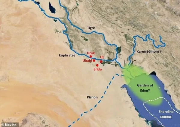
Thanks to new satellite images, there are suggestions that the Garden of Eden may have a real geographical basis / Image Mavink
Back in the early 1990s, geologist Farouk El-Baz of Boston University, while analyzing NASA radar images from the Space Shuttle Endeavour, drew attention to this dried-up riverbed. Recently, this data has been discussed again in scientific and religious circles, which has brought the topic back into the public domain.
If we combine Wadi al-Batin, Qarun, Tigris and Euphrates, they all converged in ancient times in the Persian Gulf area, forming an extremely fertile region, where in those days there could have been magnificent landscapes in the form of forests and gardens, numerous species of animals, etc. Moreover, this place is often called the cradle of the first civilizations, so ancient people could describe this fact in their myths, giving the very phenomenon of civilization a human face in the form of Adam and Eve. The expulsion from Eden thus demonstrates the process of separation of peoples, their settlement outside the region.
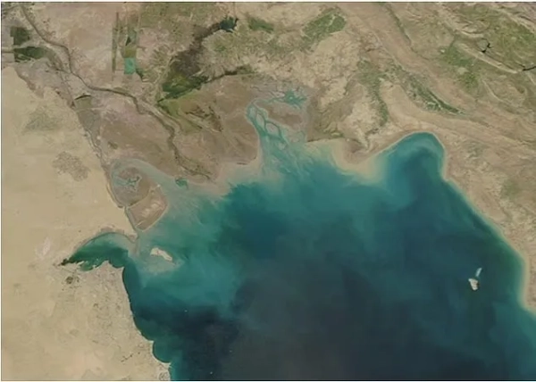
In this area, the Tigris and Euphrates rivers merge to form the Shatt al-Arab, which then flows into the Persian Gulf / Photo Daily Mail
However, there are alternative hypotheses. Some scholars insist that Gihon is the Nile, and the land of Cush was located in Africa. Others emphasize that biblical texts combine historical memory with symbolism and fiction, so attempts to accurately “put Eden on the map” remain speculative.
A separate, more radical theory emerged in 2025. Texas engineer Mahmoud Javaid suggested that Eden could have been in the Bahr Dar region of northwestern Ethiopia, near the headwaters of the Blue Nile. He combined biblical and Quranic accounts with evidence of early human evolution. But it's worth noting that this research has not been peer-reviewed.
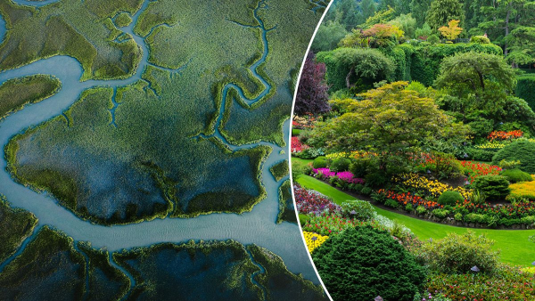
Despite the controversy, satellite maps of the Fertile Crescent show that the region was once much greener and more densely populated. Ancient rivers supported agriculture, trade, and early settlements. So it's entirely possible that these real-life landscapes formed the basis for the biblical story of a lost paradise that eventually became a parched desert.