
Main points
- Unstable weather conditions are expected in Ukraine in April, and frosts are even possible in some regions.
- Forecasters predict temperature fluctuations from -3 degrees to +20 degrees in different regions and at different times of the day.
- How cold it will be for Easter and where there will be rain, thunderstorms, or sleet – read in the interview.
- 1 What will the weather be like in the near future?
- 2 Will there be more fog in April?
- 3 Are thunderstorms possible in April and why are they difficult to predict?
- 4 Frosts and cold snaps: when will the weather get worse?
- 5 Is a sharp warming to +25 degrees possible in April?
- 6 Are temperature fluctuations normal for April?
- 7 What will the weather be like on Easter in 2026?
- 8 Will snow come to Ukraine from Europe?
- 9 Will this April be warmer or cooler than last?
After the changeable weather in March, unstable April conditions have invaded Ukraine, which may surprise with temperature changes. Some regions will experience frost, while others, on the contrary, will warm up to +20 degrees.
What will the weather be like in Ukraine in April and at Easter – will the cold snap return and will there be more snow, or, on the contrary, will there be a new wave of warming, and will there be rain and thunderstorms in the coming days – said Ivan Semilyt, a representative of the Ukrhydrometeorological Center, in an interview with Channel 24 .
What will the weather be like in the near future?
What conditions can we expect in Ukraine in the coming days – will it be sunny or will it rain? And should we expect sudden changes in the weather?
In general, we do not expect any drastic changes. The moisture and precipitation that are present now will gradually disappear. The weather in the next two days will still be determined by a field of low atmospheric pressure, so there will be light rains. There will be thunderstorms in places in the northeast of the country.
In the western regions, and already on April 5 throughout Ukraine, the weather will be dry. It will be formed by a field of high atmospheric pressure, i.e. an anticyclone from the southwest.
The fogs are caused by the fact that we will have a more humid air mass. There will also be thunderstorms, so people should be attentive and careful, check the security situation, because it can be not only thunderstorms, but also a threat from our unpleasant neighbors.
As for temperature values, we expect a stable situation in the next three days. On the afternoon of April 3, the thermometer will rise to +13…+18 degrees.
There will be no significant changes at night on April 4 – we expect +5…+10 degrees in most regions. Only in the western regions will the surface layer of air cool to +1…+6 degrees due to the decrease in cloudiness. At the same time, the daytime maximums will also differ. Almost throughout the country, it will again be +13…+18 degrees, only in the western regions – +13…+16 degrees.
On Sunday, a field of high atmospheric pressure will arrive in Ukraine, so we expect more sunny skies and weather without precipitation.
At the same time, there will be gusts of northwest wind in places, except in the western regions and Crimea, with speeds up to 15-20 meters per second, so it will be a little unpleasant.
On April 5, there will be no significant changes in temperature, the same values will remain as on the 4th. Only at night, the values will be within +1…+6 degrees throughout the territory of Ukraine, and the aforementioned +5…+10 degrees will remain only in the south and southeast.

Rain may fall in some areas / Unsplash, Yuel, illustrative
How will the weather change at the beginning of the new week, from April 6?
In general, at the beginning of next week, an atmospheric front will pass through the territory of Ukraine. The field of increased atmospheric pressure will move southward, and an atmospheric front will arrive in its place, which will cause a change in the synoptic situation.
We expect rain-free weather on the night of April 6. However, during the day, light rain will fall in the western, northern, and most central regions, and moderate rain in the Carpathians. The rest of the territory will be dry.
The air temperature at night will be within +1…+6 degrees Celsius, in the south and west of the country – +3…+9 degrees, in the daytime we expect +10…+16 degrees. In the southern part and in places in the central regions, the thermometer will rise to +20 degrees.
On Tuesday, April 7, we expect light rain, and moderate rain in the south and east of the country. In the Carpathians, it will be accompanied by wet snow.
At night, in most western and northern regions, and during the day in Transcarpathia and Prykarpattia, the weather will be dry without precipitation. The temperature will again not undergo significant changes – during the day it will drop to +5…+11 degrees, in the southern part – to +10…+15 degrees.
Will there be more fog in April?
Fog may appear in some places in Ukraine in the coming days. Why is it appearing now?
In general, during the transitional seasons, when the temperature is not very stable, we can have different types of fog. They are advective and radiative. It is important to distinguish here that radiation fogs are not related to radiation in any way , it is just a name. There is also evaporation fog.

Fog can often occur in April / Unsplash, Jenish Pansuriya, illustrative
Radiation fog, for example, forms at night – in clear weather and light winds, when the earth's surface intensively radiates heat and cools. Along with it, the surface layer of air cools, which leads to the condensation of water vapor. It is most often observed in lowlands and valleys in general.
Advective fog occurs when warm, moist air moves over a cold surface, such as water or cold land. The air quickly cools to its dew point, forming a fog-like mass. This type of fog is generally found along coastal areas and can be long-lasting.
For example, last week there was very thick fog over the Dnieper River, but at the same time there was high visibility throughout Kyiv.
Evaporative fog, on the other hand, occurs when cold air moves over a warmer water surface, resulting in intense evaporation, which enriches the air with moisture and immediately condenses.
Are thunderstorms possible in April and why are they difficult to predict?
Recently, forecasters have warned at least several regions about the onset of the first spring thunderstorms. Will they be frequent in April?
Previously, thunderstorm forecasting was more advanced than it is now, due to the fact that radar installations were available in Ukraine, which helped forecasters generally navigate where thunderstorms would occur in our country.
Currently, due to a full-scale war, the radar installations have been destroyed – on the very first day, February 24, 2022, they were destroyed by the Russians. Currently, weather forecasters are essentially working with thunderstorms blindly. We do not have air sounding, that is, we cannot scan the atmosphere and how all the processes develop there. So we cannot track locationally where thunderstorms will form in our country.
And this is a big problem, so now, in general, forecasters track everything using weather maps and satellites. The latter track exactly where it's happening in real time.
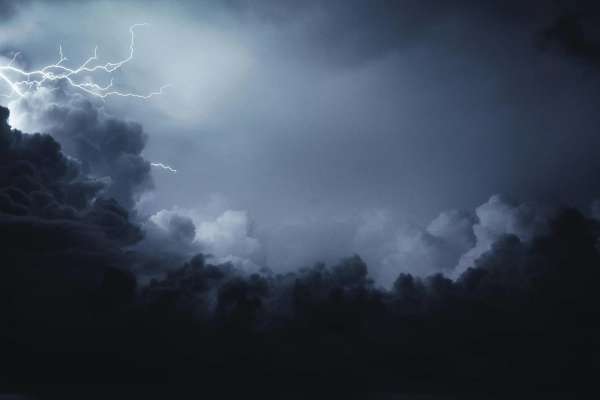
Thunderstorms may return to Ukraine / Unsplash, Levi Guzman, illustrative
It is very difficult to predict a thunderstorm in advance, but our forecasters are working on it. But currently, as forecasters, we can only predict a thunderstorm 2 days in advance, a maximum of 3.
That is, predicting what will happen there in a week, whether there will be a thunderstorm or not, is difficult, because this is a very fast-developing phenomenon. Due to the fact that the observation facilities are destroyed, it is much more difficult to work with this.
Frosts and cold snaps: when will the weather get worse?
Information is being spread online about a possible drop in temperatures in the near future, in particular, on April 9-10. Will the cold snap really come?
In general, if we look at our forecast from the Ukrhydrometeorological Center, we are making a more approximate, advisory forecast for 6-10 days.
Now, according to this approximate forecast, we expect a cold snap and precipitation in some places. The temperature will drop to freezing at night – that is, it will be 0…-3 degrees. And this is a dangerous phenomenon for plants.
If frosts are indeed possible again in the future, forecasters will issue appropriate warnings.
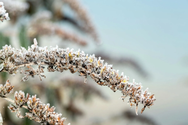
Frost is possible this month / Unsplash, David Griffiths, illustrative
The daytime highs on those days next week will also not be as high as they are now, or as they were in March. The daytime temperature will be within +1…+8 degrees Celsius. Only in the southern part will it be +1…+6 degrees at night, and within +7…+13 degrees during the day.
Is it appropriate to use the term “freeze” now, or can the probable decreases still be considered frosts?
We can already use the term freezing, since the growing season has begun, so a drop below 0 degrees is already freezing and in no case frost.
Reference: The growing season is a time of active plant growth and development, when the average daily temperature consistently exceeds +5 degrees.
Is a sharp warming to +25 degrees possible in April?
Are there any signs that would indicate a possible increase in temperature even to +20…+25 degrees in Ukraine in April?
In general, if we look at the characteristics of the month, April is a colorful month, characterized by a rapid increase in heat. In addition, thunderstorms are beginning to be observed throughout the territory of Ukraine. And if we look at the climatic characteristics of April, the absolute maximums fluctuate within 25 – 30 degrees Celsius.
That is, if we look at the entire history of observations, then in general an increase to +25 is possible. However, we will not record such values over the next 10 days. Currently, it can only be up to +20 degrees.
Are temperature fluctuations normal for April?
After the recent cold snap, we are expecting temperatures to rise again in the coming days. However, it won't be for long, as a new wave of cold snap is forecast by the end of next week. Are such changes normal for this period of spring?
In general, spring is a transitional season between winter and summer. March and April are volatile months, with the situation mostly stabilizing in May.
That is, April, again, can take a little from both winter and summer. If we return to the climatic characteristics, then the absolute minimums across the territory of Ukraine during this period were within 6 – 16 degrees below zero. In Chernivtsi, Chernihiv, Sumy and Kharkiv regions, in some places there could be a decrease to -22 degrees below zero.
These are manifestations of our weather and our climate in general. Therefore, in April, there can be different temperature values in some places – both up to +33 and -22 degrees.
What will the weather be like on Easter in 2026?
Considering the preliminary forecast, what kind of weather should we expect for the Easter holidays in Ukraine?
The tentative forecast indicates that there will be occasional precipitation and, as I already said, we will have a drop in temperature at night to frost – 0…-3 degrees. It will be a little warmer in the southern part, so we expect +1…+6 degrees at night there.
However, daytime highs from April 8 to 12 will be quite cool. In most regions, they will be within +1…+8 degrees Celsius. In the south of the country, it will be a little warmer – +7…+13 degrees.

A cold snap is possible for Easter / Unsplash, Jason Mayer, illustrative
Will snow come to Ukraine from Europe?
Snow has recently fallen in some European countries. Are there any signs that similar conditions could come to Ukraine and snow will fall here too?
It largely depends on how processes develop in these countries and where they will move in the future.
Currently, we are observing that precipitation in the form of rain and sleet can only occur in the Carpathians, since a warmer air mass prevails over us. And in general, our precipitation is mostly in the form of rain.
Therefore, we do not expect such weather conditions with snow at the moment. Since the synoptic processes that are developing in Ukraine are bringing precipitation to us from the south, and not from those countries where precipitation is currently falling in the form of snow.
Will this April be warmer or cooler than last?
Considering last year's data, is it possible to say now whether this year's April will be warmer or cooler than April 2025?
This kind of analysis is generally done by climatologists, as they are more familiar with it and compare what changes occur from year to year. Therefore, it is a little difficult to say what will happen this year compared to last.
But if we look at the forecast for the average monthly air temperature and precipitation in April this year, we expect the average monthly temperature to be 8-11 degrees Celsius, which is within normal limits. Precipitation will be within 30-50 millimeters, which is also within normal limits.